Pasture, Rangeland, Forage
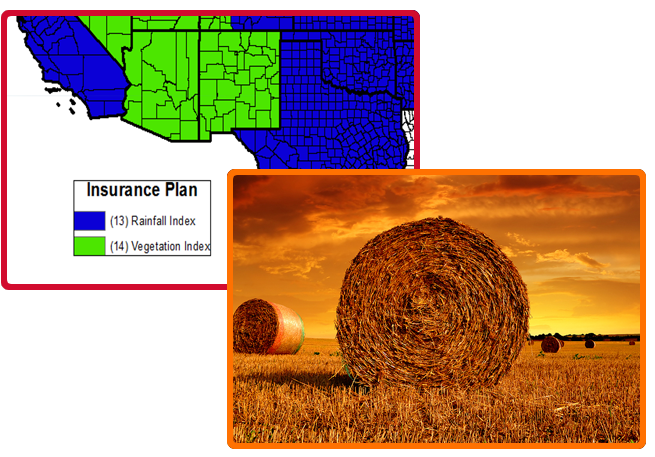
 Pasture, Rangeland, and forages cover approximately 55 percent of all U.S. land. Forage grows differently in different areas, so it’s important for farmers and ranchers to know which types and techniques work best for their region. The following insurance programs for pasture, rangeland, and forage (PRF) utilize various indexing systems to determine conditions.
RAINFALL AND VEGETATION INDEX PLAN COMMON POLICY (2020)
2019 Rainfall Index (RI) is based on weather data collected and maintained by NOAA’s Climate Prediction Center. The index reflects how much precipitation is received relative to the long-term average for a specified area and timeframe.
See our 2019 Rainfall Dual Option FAQ
- County Availability: Map Viewer
- Basic Provisions
- 2020 Crop Provisions
- Insurance Standards Handbook
- Grid ID Locator, Decision Support Tool, Historical Indices
- 2020 Summary of Change to Annual Forage for 2020 Crop Year
Vegetation Index (VI) – is based on the U.S. Geological Survey’s Earth Resources Observation and Science (EROS) normalized difference vegetation index (NDVI) data derived from satellites observing long-term changes in greenness of vegetation of the earth since 1989.
- County Availability (PDF): Map | Text
- Basic Provisions (PDF)
- Policy Provisions (PDF)
- Insurance Standards Handbook (PDF) (Revised Apr 2013)
- Grid ID Locator, Decision Support Tool, Historical Indices
- Downloadable Interactive PRF Spreadsheet – Total Loss Factor: XLS | PDF
Forage Production Index – is based on NASS county level hay yield data (all hay or alfalfa hay). The index reflects how much hay is produced relative to the long-term trend for the county. Coverage is available for forage production in select counties.